Inscription
Though located far from any site of armed conflict, Finn's Point National Cemetery exists as a direct result of the American Civil War. It is the resting place for the remains of 2,436 Confederate soldiers whose military careers ended as prisoners of war under the Union forces. These men were interned 1½ miles from here at Fort Delaware on Pea Patch Island. One hundred thirty-five Union soldiers who died while serving as guards at the prison camp, are also buried here.
Additional Interments
A few interments have been made for members of the U.S. Armed Forces from the Spanish-American War, World War I, and soldiers who served at nearby Fort Mott when it was an active military installation. In the northwest corner, 13 white marble headstones mark the burial place of German prisoners of World War II who died while in custody at Fort Dix, New Jersey. The cemetery is now closed for future interments except for cremated remains.
Details
| HM Number | HMEAP |
|---|---|
| Tags | |
| Placed By | State of New Jersey Division of Parks & Forestry and National Park System |
| Marker Condition | No reports yet |
| Date Added | Thursday, September 4th, 2014 at 9:13am PDT -07:00 |
Pictures
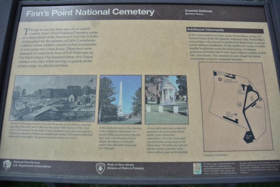
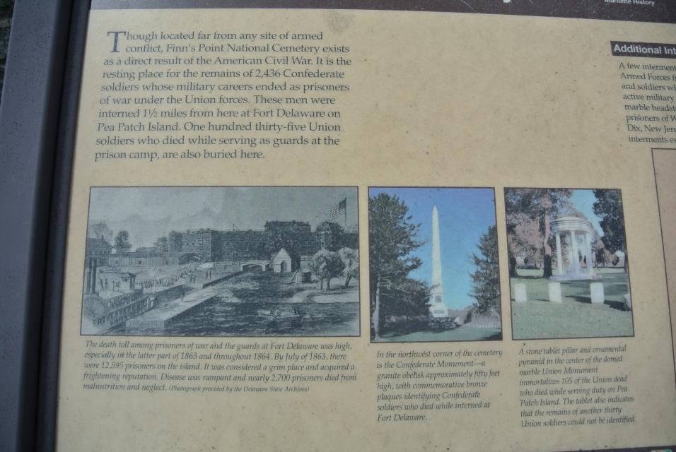
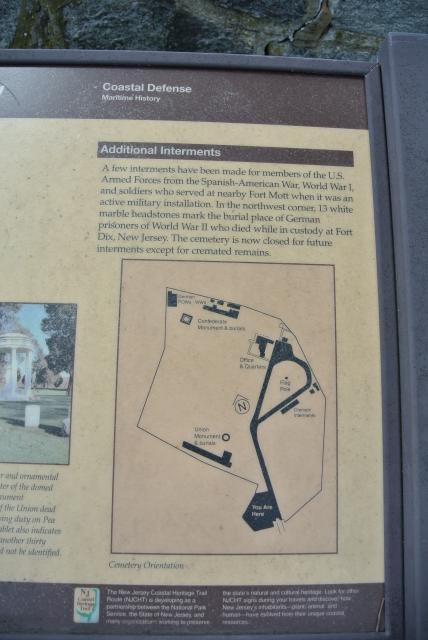


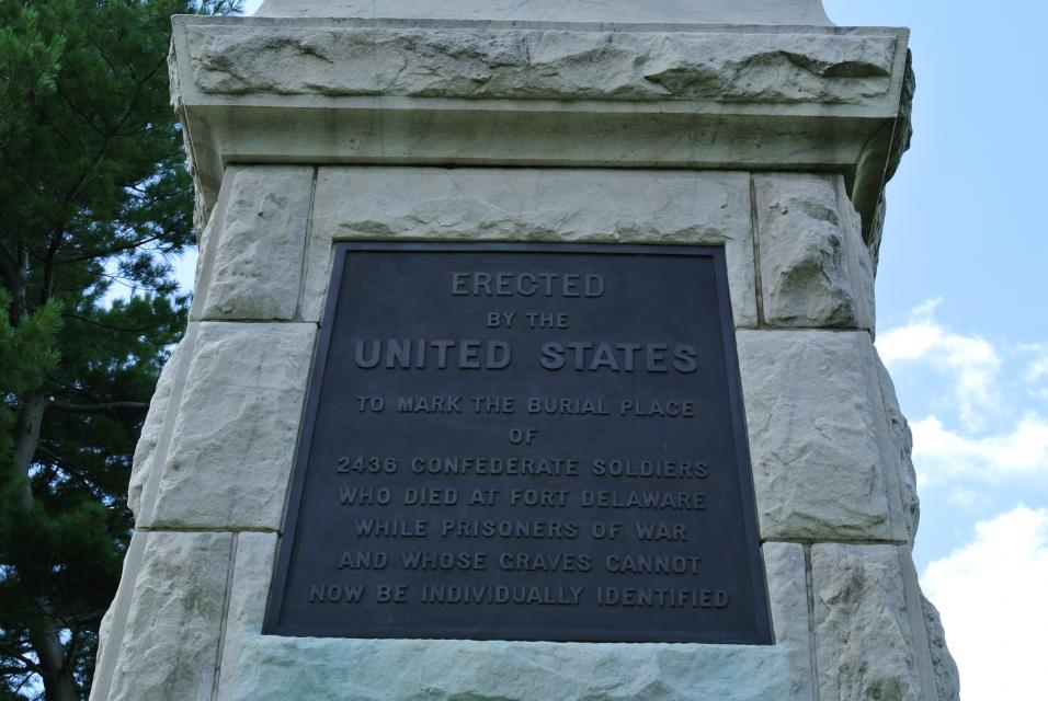
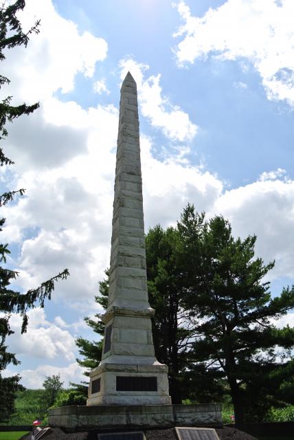
Photo Credits: [1] BRIDGER1963 [2] BRIDGER1963 [3] BRIDGER1963 [4] BRIDGER1963 [5] BRIDGER1963 [6] BRIDGER1963 [7] BRIDGER1963
Locationbig map
| UTM (WGS84 Datum) | 18S E 452311 N 4384680 |
|---|---|
| Decimal Degrees | 39.61055000, -75.55553333 |
| Degrees and Decimal Minutes | N 39° 36.633', W 75° 33.332' |
| Degrees, Minutes and Seconds | 39° 36' 37.98" N, 75° 33' 19.92" W |
| Driving Directions | Google Maps |
| Area Code(s) | 609, 856 |
| Closest Postal Address | At or near 456 Fort Mott Rd, Pennsville Township NJ 08070, US |
| Alternative Maps | Google Maps, MapQuest, Bing Maps, Yahoo Maps, MSR Maps, OpenCycleMap, MyTopo Maps, OpenStreetMap |
Is this marker missing? Are the coordinates wrong? Do you have additional information that you would like to share with us? If so, check in.
Nearby Markersshow on map
Show me all markers in: Pennsville Township, NJ | Salem County | 08070 | New Jersey | United States of America
Maintenance Issues
- Is this marker part of a series?
- What historical period does the marker represent?
- What historical place does the marker represent?
- What type of marker is it?
- What class is the marker?
- What style is the marker?
- Does the marker have a number?
- What year was the marker erected?
- Can this marker be seen from the road?
- Is the marker in the median?
Comments 0 comments