Inscription
Just upstream from this location, a dam has slowed the waters of the Neuse River for more than 150 years. The greenway bridge is a great place to see the dam.
Mid-1800s — Paper Mill
In the mid-1800s, the original Miburnie Dam eight feet tall and made of wood. Water flowing over this dam powered a paper mill, reportedly destroyed during Union occupation in April 1865.
Early-1900s — Hydroelectric Plant
Around 1900, the dam was rebuilt with rock and masonry and a hydroelectric plant was added. Electricity from this plant powered Raleigh's streetcars via a 6,600 volt line that ran six miles into Raleigh. The plant was in use several years before it was dismantled.
Mid-1930s — Gristmill
In the mid-1930s, water flowing over the dam powered a gristmill where farmers could bring corn to be ground into meal or flour. The mill stopped operation in the 1940s and later the building burned.
1980s — Hydroelectric Plant
Another hydroelectric plant was built on the Milburnie Dam in the early 1980s. It was operational for several years before shutting down. (pictured on right)
Today — Wildlife Habitat
Although the dam is no longer used to grind corn or make electricity, the impounded waters behind the dam have created wildlife habitat. Areas of deep, slow-moving water and the adjacent wetlands are home to to fish, beavers, water snakes, hawks, herons, turtles and more.
The Future
When old dams no longer serve their original purpose, they are sometimes removed to restore rivers to their original channels. This could be the fate of Milburnie Dam which would bring both hydrologic and wildlife habitat changes to this area of the Neuse River.
(captions)
Map of Milburnie Dam and Neuse River Trail. Notice the large wetlands on the east side of the river behind the dam.
Raleigh Street Car from the early 1900s.
Downstream of Milburnie Dam - Old powerhouse structure from 1980s is on the left.
Details
| HM Number | HM1OZK |
|---|---|
| Tags | |
| Marker Condition | No reports yet |
| Date Added | Saturday, October 31st, 2015 at 9:01pm PDT -07:00 |
Pictures
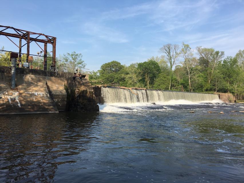
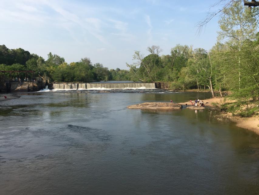
Photo Credits: [1] SEAN H ANDERSON [2] SEAN H ANDERSON
Locationbig map
| UTM (WGS84 Datum) | 17S E 722221 N 3964464 |
|---|---|
| Decimal Degrees | 35.79916667, -78.54083333 |
| Degrees and Decimal Minutes | N 35° 47.95', W 78° 32.45' |
| Degrees, Minutes and Seconds | 35° 47' 57" N, 78° 32' 27" W |
| Driving Directions | Google Maps |
| Area Code(s) | 919 |
| Closest Postal Address | At or near Neuse River Greenway Trail, Raleigh NC 27604, US |
| Alternative Maps | Google Maps, MapQuest, Bing Maps, Yahoo Maps, MSR Maps, OpenCycleMap, MyTopo Maps, OpenStreetMap |
Is this marker missing? Are the coordinates wrong? Do you have additional information that you would like to share with us? If so, check in.
Nearby Markersshow on map
Maintenance Issues
- Is this marker part of a series?
- What historical period does the marker represent?
- What historical place does the marker represent?
- What type of marker is it?
- What class is the marker?
- What style is the marker?
- Does the marker have a number?
- What year was the marker erected?
- Who or what organization placed the marker?
- This marker could use another picture or two.
- Can this marker be seen from the road?
- Is the marker in the median?
Comments 0 comments