Inscription
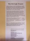
35 Calhoun Street was built in 1852 and occupied by Irish immigrants.
It was purchased by Willis Johnson, Sr. in 1939.
His sons, Frank and Henry built 35½ Calhoun with their own hands to completecarpentry apprenticeships.
The houses are still owned by Willis Johnson's Sr. Family.
It was bounded by Laurens, Charlotte, Concord and Meeting Streets.
Here, African American families fostered close relationships and rich cultural life.
Their community was steeped in the belief that "it takes a village to raise a child."
Just east of the spot-in what is known as Ansonborough Field-stood the Ansonborough Homes. Built in 1940 for over 160 families, the structures were vacated in 1992 upon discovery of toxic-waste deposits in the soil. Their demolition the following year regrettably erased a significant piece of history relevant to Charleston's black community.
These two houses are the last vestiges of The Borough and have steadfastly resisted gentrification. They remain monuments to the lives and contributions of African-Americans who made The Borough their home.
These photographs [included] depict life in The Borough as it existed five decades ago.
Details
| HM Number | HMZZW |
|---|---|
| Tags | |
| Historical Period | 19th Century |
| Historical Place | Home |
| Marker Type | Historic Home |
| Marker Class | Historical Marker |
| Marker Style | Carved Stone |
| Year Placed | 2006 |
| Placed By | Moja Arts Festival City of Charleston 2006 |
| Marker Condition | No reports yet |
| Date Added | Tuesday, September 30th, 2014 at 1:35am PDT -07:00 |
Pictures
Locationbig map
| UTM (WGS84 Datum) | 17S E 600274 N 3628379 |
|---|---|
| Decimal Degrees | 32.78878333, -79.92915000 |
| Degrees and Decimal Minutes | N 32° 47.327', W 79° 55.749' |
| Degrees, Minutes and Seconds | 32° 47' 19.6200" N, 79° 55' 44.9400" W |
| Driving Directions | Google Maps |
| Area Code(s) | 843 |
| Can be seen from road? | Yes |
| Is marker in the median? | No |
| Closest Postal Address | At or near 41 Calhoun St, Charleston SC 29401, US |
| Alternative Maps | Google Maps, MapQuest, Bing Maps, Yahoo Maps, MSR Maps, OpenCycleMap, MyTopo Maps, OpenStreetMap |
Is this marker missing? Are the coordinates wrong? Do you have additional information that you would like to share with us? If so, check in.
Nearby Markersshow on map
Show me all markers in: Charleston, SC | Charleston County | 29401 | South Carolina | United States of America
Maintenance Issues
- Is this marker part of a series?
- Which side of the road is the marker located?


Comments 0 comments