Inscription
Panther Revisited
The community of Panther was located where you are currently standing. In the late 1800s, three buildings stood on this site: a blacksmith shop, a tin shop, and a general store. As Panther continued to grow, a creamery and post office also served the area. The blacksmith shop sat on the northeast side of the intersection. Like many Iowa blacksmiths, Amos Royer repaired farm machinery and shoed horses. The tin shop sat on the southwest side of the intersection and was operated by Will Beazor. Mr. Beazor repaired windmills and pumps.The original Panther store started in response to the business the blacksmith and tin shops were generating. The original store sat on the southeast corner of the intersection and was operated by Israel Beaver. In February of 1898 a group of farmers started a new general store building on the northwest corner (where you are now). Because it served a vast area, the Panther store sold a wide variety of things. It also served as a place to socialize on Saturday nights.
It was the construction of Highway 44 that brought the most change to Panther. The road linked the Panther area with the neighboring communities. Eventually a garage was built at Panther as more people began to drive cars and needed repairs for those cars. However as people depended more on the automobile, the store lost most of its business to larger towns. As the years passed and business declined, Panther soon vanished from the roadside. All that remains is the foundation of the garage on the northeast side of the intersection and memories.
Details
| HM Number | HMKLG |
|---|---|
| Tags | |
| Placed By | Tileyard Hill Questers |
| Marker Condition |  10 out of 10 (1 reports) |
| Date Added | Wednesday, October 15th, 2014 at 3:16pm PDT -07:00 |
Pictures
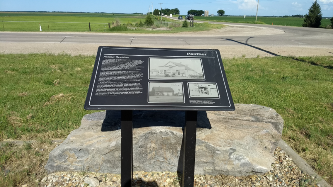

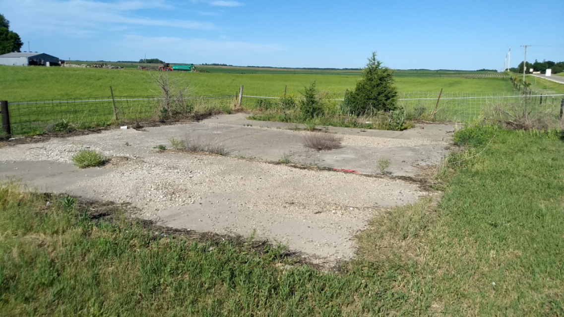
Photo Credits: [1] JIM ASBILLE [2] JIM ASBILLE [3] JIM ASBILLE
Locationbig map
| UTM (WGS84 Datum) | 15T E 407974 N 4615791 |
|---|---|
| Decimal Degrees | 41.68858333, -94.10580000 |
| Degrees and Decimal Minutes | N 41° 41.315', W 94° 6.348' |
| Degrees, Minutes and Seconds | 41° 41' 18.90" N, 94° 6' 20.88" W |
| Driving Directions | Google Maps |
| Area Code(s) | 515 |
| Closest Postal Address | At or near 2399 Co Hwy P58, Adel IA 50003, US |
| Alternative Maps | Google Maps, MapQuest, Bing Maps, Yahoo Maps, MSR Maps, OpenCycleMap, MyTopo Maps, OpenStreetMap |
Is this marker missing? Are the coordinates wrong? Do you have additional information that you would like to share with us? If so, check in.
Nearby Markersshow on map
I Saw The Marker
The marker is in excellent condition and is much more interesting than the view.
Jun 4, 2017 at 5:19pm PDT by jimasbille
Maintenance Issues
- Is this marker part of a series?
- What historical period does the marker represent?
- What historical place does the marker represent?
- What type of marker is it?
- What class is the marker?
- What style is the marker?
- Does the marker have a number?
- What year was the marker erected?
- Can this marker be seen from the road?
- Is the marker in the median?
Comments 0 comments