Inscription
(first marker) The Concord Point Light Keeper's House and Property
Constructed by John Donahoo of Havre de Grace, Builder of Twelve Maryland Light Houses. 1827-1920
The house and property were sold by the U.S.Government in April 1920 as the light had been automated and a resident keeper was no longer necessary. The house was a residential rental property until the mid 1930s when it was converted to a restaurant. A long outbuilding to the south became a bar and dance hall. The property changed hands nine times between 1920 and 1988 when it was purchased by the Maryland Historic Trust and deeded to the City of Havre de Grace. From 1920 to 1988, the property underwent many renovations and additions until it appears as it does in the photograph at the left. The Friends of the Concord Point Lighthouse, Inc. began the restoration of the light keeper's house and property in 1990.
The restoration of the Light Keeper's House was achieved with grant assistance by the Maryland Historic Trust, the Lower Susquehanna Heritage Greenway, support of the Harford County government, the City of Havre de Grace and fund raising efforts of the Friends of Concord Point Lighthouse. The house is restored to its appearance circa 1890-1900. The original cottage with attached kitchen of 1827 was renovated to this two story structure in 1884.
(second marker) The Concord Point Light Keeper's House and Property 1827-1920
The Well was placed in the southeast corner of the property in 1827. The only description of the well comes from the fourth paragraph of the construction contract.
"Also a well to be sunk of such depth as to produce good water, at a convenient distance from the house, to be stoned or bricked up and furnished with a pump, or with a curb, windlass and an iron chain, and a strong iron-hooped bucket".
Our research indicates the well had a pump centered on the cover.
The 17 x 15 foot Pump House was constructed over the well in 1851. A seven foot wide Coal Shed was attached to the west exterior of the Pump House. These two outbuildings are shown in the illustrations.
(third marker) The Concord Point Light Keeper's House and Property 1827-1920
A structure was added to the west side of the Coal Shed by 1904. This structure was referred to as the Low Stable in the Lighthouse Service accounts. The Low Stable was replaced by a structure referred to as the High Stable by 1910, when the postcard picture seen at the right was produced. Archival evidence indicates this structure was used for storage. All the outbuildings along this south side of the property were replaced by one long structure around 1920.
In 1884 the one and one-half story cottage (see interpretive sign east of Concord Street) was renovated to a full two story structure. Between 1884 and 1990 a summer kitchen was added to the west wing or the house. The house remained in this configuration for most of its use as the light keeper's residence. Several changes to the property were made after the 1884 renovation. Researchers believe many of the changes were the result of periodic damage from major ice 'gorges' on the Susquehanna River.
(fourth marker) The Concord Point Light Keeper's House and Property 1827-1920
The light keeper's property included the entire block bounded by Concord Street to the east, Lafayette Street to the south Alliance Street to the north and Young Street to the west. A fence surrounding the property was erected in 1828. The area to the west of the fence dividing the property was called the pasture. Wooden walkways led from the dwelling to Young Street and the privy.
The third paragraph of the building instructions of the 1827 contract described the construction of a Privy;
"Also outhouse or privy at convenient distance from the dwelling of stone or brick five feet by five in the clear, with a well at least eight feed deep, walled up with stone or brick; the roof to be well shingled."
The privy seen at the far left in the 1905 photograph may be a replacement of the one constructed in 1827.
Details
| HM Number | HMAL |
|---|---|
| Tags | |
| Historical Period | 19th Century |
| Historical Place | Home |
| Marker Type | Historic Building |
| Marker Class | Historical Marker |
| Marker Style | Free Standing |
| Placed By | Friends of Concord Point Lighthouse and the Chesapeake Bay Gateways Network |
| Marker Condition | No reports yet |
| Date Added | Tuesday, September 9th, 2014 at 7:02am PDT -07:00 |
Pictures

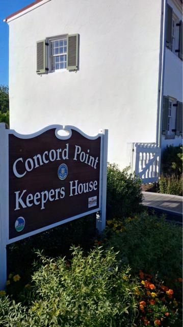
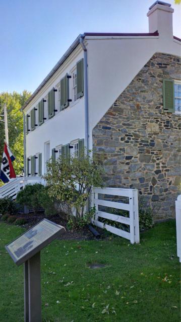
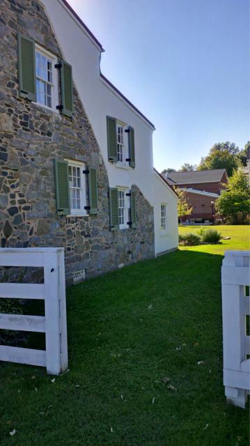

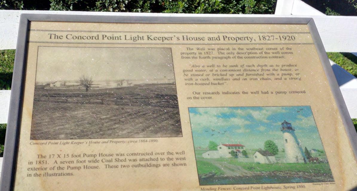
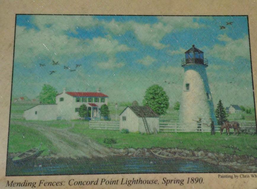
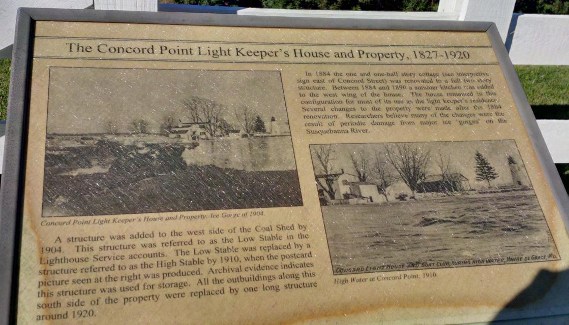

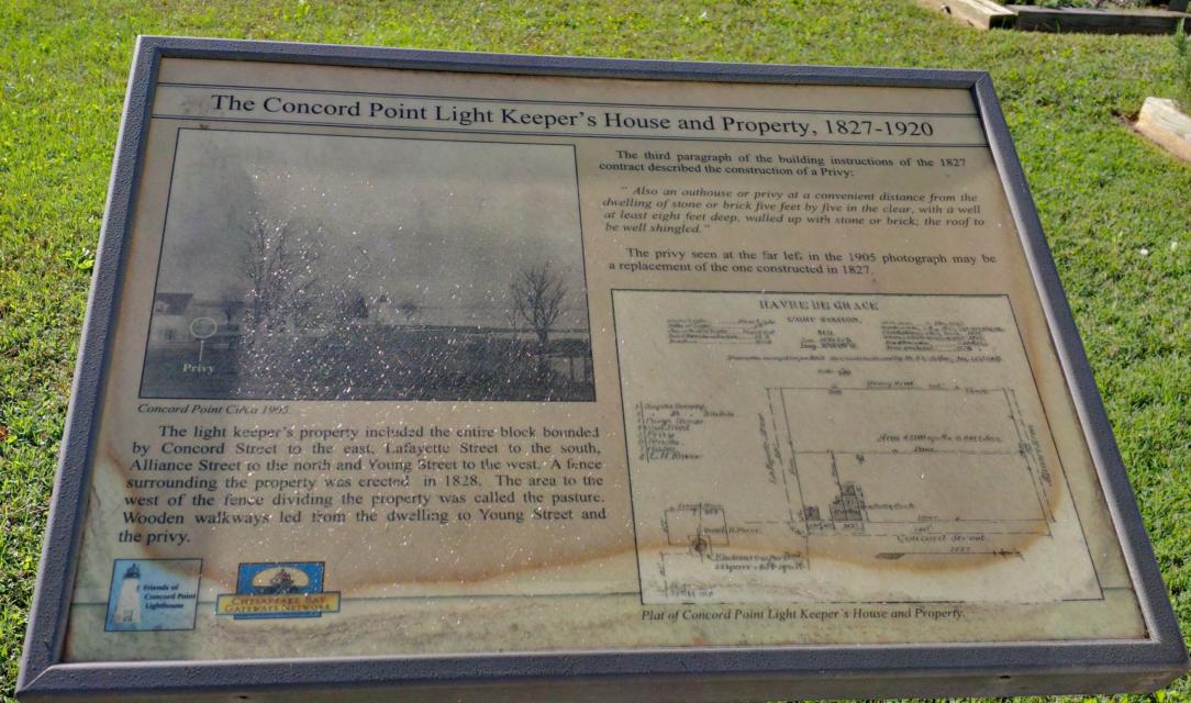

Photo Credits: [1] SEPTEMBERSPARROW1666 [2] SEPTEMBERSPARROW1666 [3] SEPTEMBERSPARROW1666 [4] SEPTEMBERSPARROW1666 [5] SEPTEMBERSPARROW1666 [6] SEPTEMBERSPARROW1666 [7] SEPTEMBERSPARROW1666 [9] SEPTEMBERSPARROW1666 [10] SEPTEMBERSPARROW1666 [11] SEPTEMBERSPARROW1666 [12] SEPTEMBERSPARROW1666
Locationbig map
| UTM (WGS84 Datum) | 18S E 406749 N 4377352 |
|---|---|
| Decimal Degrees | 39.54078333, -76.08520000 |
| Degrees and Decimal Minutes | N 39° 32.447', W 76° 5.112' |
| Degrees, Minutes and Seconds | 39° 32' 26.8200" N, 76° 5' 6.7200" W |
| Driving Directions | Google Maps |
| Area Code(s) | 443, 410 |
| Can be seen from road? | Yes |
| Is marker in the median? | No |
| Which side of the road? | Marker is on the right when traveling South |
| Closest Postal Address | At or near 701 Concord St, Havre de Grace MD 21078, US |
| Alternative Maps | Google Maps, MapQuest, Bing Maps, Yahoo Maps, MSR Maps, OpenCycleMap, MyTopo Maps, OpenStreetMap |
Is this marker missing? Are the coordinates wrong? Do you have additional information that you would like to share with us? If so, check in.
Related Markers
Maintenance Issues
- Is this marker part of a series?
Comments 0 comments