Inscription
Heritage Rail Trail County Park
The Codorus Creek attracted this area's first European settlers, who used its water to power mills. The Creek's flat floodplain was also ideal territory for trains. In 1839, the Baltimore and Susquehanna, forerunner of the Northern Central Railway, built a station nearby. Soon, the little settlement became a real town, receiving its own post office in 1843. Access to trains allowed the mills to expand their business. By the 1880s, products made in Glen Rock included flour, rope, twine, window sashes, and carriages.What's in a Name?
This town was originally called Heathcote Station, after the man who owned most of the area. In fact, it was William Heathcote who suggested "Glen Rock." The name refers to both the town's location (a glen is a small, secluded valley) and a prominent rock outcrop exposed by railroad construction.
Flood!
Glen Rock is naturally flood-prone. After all, a creek runs right through the town's center. Also, when it rains, water races down the steep hills surrounding the town and collects in the stream. In 1972, Hurricane Agnes caused the worst flood in Glen Rock's history.
Glen Rock c.1900
Historic images from the collection of the York County Heritage Trust, York, PA
Details
| HM Number | HM1JZ1 |
|---|---|
| Tags | |
| Historical Period | 19th Century |
| Historical Place | Town |
| Marker Type | Historic District |
| Marker Class | Historical Marker |
| Marker Style | Free Standing |
| Placed By | York County Parks |
| Marker Condition | No reports yet |
| Date Added | Saturday, April 11th, 2015 at 6:01pm PDT -07:00 |
Pictures
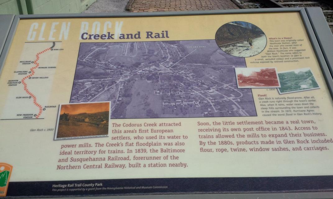
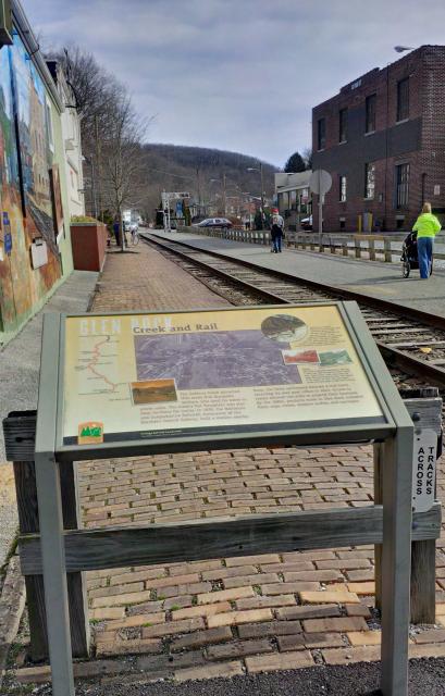
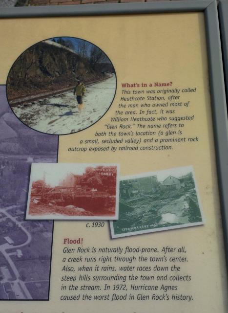
Photo Credits: [1] SEPTEMBERSPARROW1666 [3] SEPTEMBERSPARROW1666
Locationbig map
| UTM (WGS84 Datum) | 18S E 351686 N 4406365 |
|---|---|
| Decimal Degrees | 39.79433333, -76.73228333 |
| Degrees and Decimal Minutes | N 39° 47.66', W 76° 43.937' |
| Degrees, Minutes and Seconds | 39° 47' 39.6000" N, 76° 43' 56.2200" W |
| Driving Directions | Google Maps |
| Area Code(s) | 717 |
| Can be seen from road? | No |
| Is marker in the median? | No |
| Which side of the road? | Marker is on the right when traveling North |
| Closest Postal Address | At or near Heritage Rail Trail County Park, Glen Rock PA 17327, US |
| Alternative Maps | Google Maps, MapQuest, Bing Maps, Yahoo Maps, MSR Maps, OpenCycleMap, MyTopo Maps, OpenStreetMap |
Is this marker missing? Are the coordinates wrong? Do you have additional information that you would like to share with us? If so, check in.
Nearby Markersshow on map
Show me all markers in: Glen Rock, PA | York County | 17327 | Pennsylvania | United States of America
Maintenance Issues
- Is this marker part of a series?
Comments 0 comments