Inscription
Slave/Workers Quarters, ca 1855
Hampton National Historic Site
To our eyes, the stone facades and decorative woodwork that adorn these buildings seem at odds with their use as slave quarters. But the entire farm site—based on a popular European architectural concept called ferme ornee (ornamental farm)—was intentionally designed to look like a picturesque village. Such ornamentation offered the Ridgelys a more pleasing view from the mansion. The living quarters were located in the center of the farm, in close proximity to places of work. Enslaved families were often large and the space was likely crowded. Most slaves had few personal possessions, and children likely slept on a straw mattress on the floor. After Emancipation those buildings housed tenant farmers.
(Inscription in the lower right) This photograph shows the quarters as they looked in 1897 when tenant farmers resided here. Ashes, used for making soap, were collected in the small stone house to the left. Some of the tenant farmers had been or were descended from slaves on the estate.
Details
| HM Number | HM1HRM |
|---|---|
| Tags | |
| Historical Period | WW II, 19th Century |
| Historical Place | Plantation, National Register of Historic Places, Mill |
| Marker Type | Historic District |
| Marker Class | Historical Marker |
| Marker Style | Free Standing |
| Placed By | National Park Service-United States Department of the Interior |
| Marker Condition | No reports yet |
| Date Added | Tuesday, November 11th, 2014 at 9:05am PST -08:00 |
Pictures


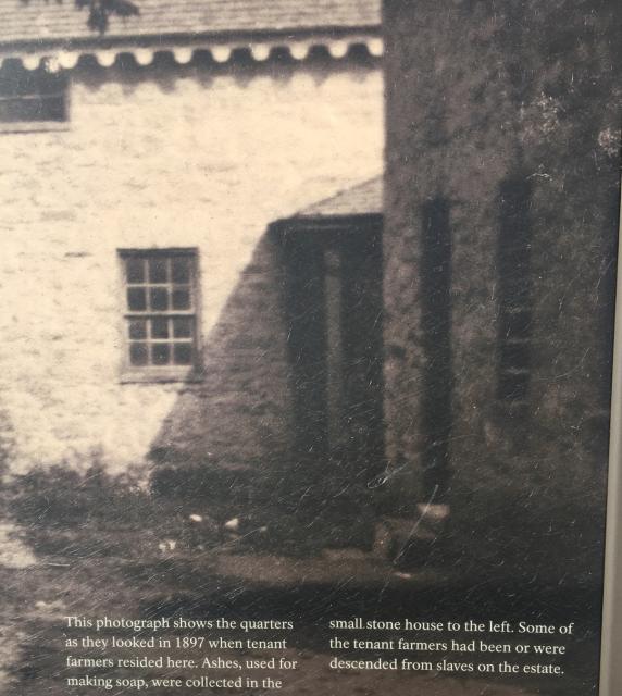
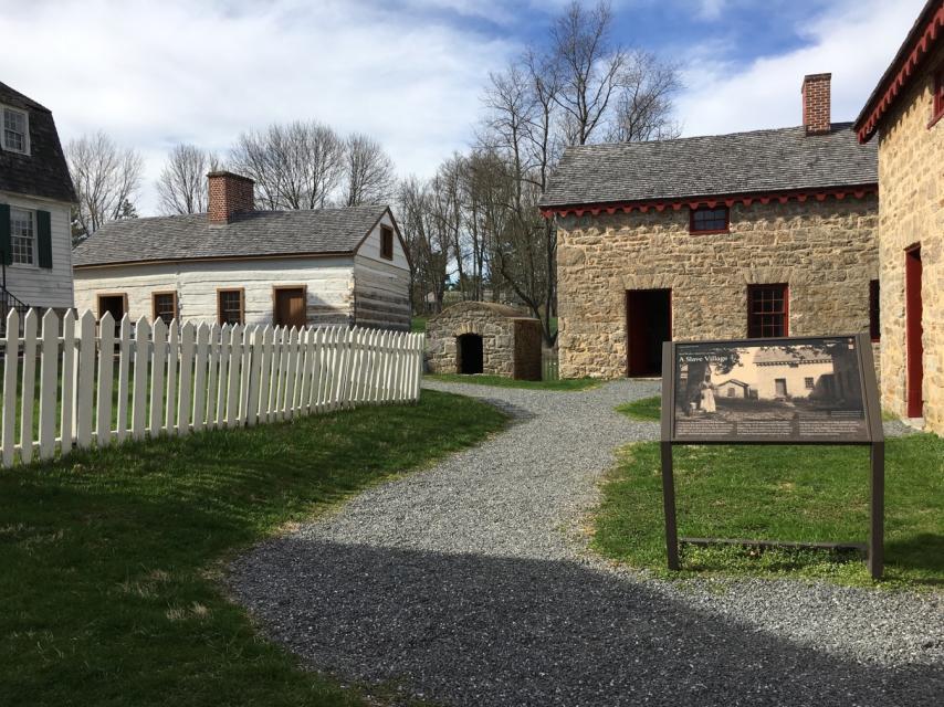
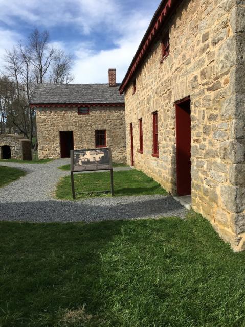
Photo Credits: [1] SEPTEMBERSPARROW1666 [2] SEPTEMBERSPARROW1666 [3] SEPTEMBERSPARROW1666 [4] SEPTEMBERSPARROW1666 [5] SEPTEMBERSPARROW1666
Locationbig map
| UTM (WGS84 Datum) | 18S E 363470 N 4364652 |
|---|---|
| Decimal Degrees | 39.42060000, -76.58610000 |
| Degrees and Decimal Minutes | N 39° 25.236', W 76° 35.166' |
| Degrees, Minutes and Seconds | 39° 25' 14.1600" N, 76° 35' 9.9600" W |
| Driving Directions | Google Maps |
| Area Code(s) | 410, 443 |
| Can be seen from road? | No |
| Is marker in the median? | No |
| Closest Postal Address | At or near 604 Stone Barn Rd, Towson MD 21286, US |
| Alternative Maps | Google Maps, MapQuest, Bing Maps, Yahoo Maps, MSR Maps, OpenCycleMap, MyTopo Maps, OpenStreetMap |
Is this marker missing? Are the coordinates wrong? Do you have additional information that you would like to share with us? If so, check in.
Nearby Markersshow on map
Maintenance Issues
- Is this marker part of a series?
- Which side of the road is the marker located?
Comments 0 comments