Inscription
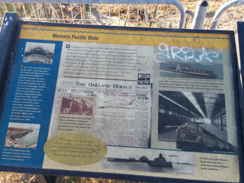
On a January morning in 1906, two hundred workmen from Western Pacific Railway and thirty armed "company soldiers" landed on the north training wall and began laying track. Although the City of Oakland had invited this action, it was considered a brazen challenge to the Southern Pacific's long standing monopoly of the waterfront. Southern Pacific promptly sued, claiming ownership of all land along the waterfront. In 1907, the court ruled against Southern Pacific in its suit. The result: Oakland regained control of most of its waterfront.
"The advent of the Western Pacific Railway is epochal... for the system's coming made it possible for Oakland to recover control and possession of its magnificent waterfront." - Oakland Mayor Frank K. Mort, 1910.
Sidebar, on left
This is the site of the Western Pacific Mole, which opened in 1910 and extended nearly two-miles out from Oakland's natural shoreline. The term "mole" refers to an earth or stone-filled breakwater, such as a ferry anchorage, that juts out into deep water. Ferries were crucial to Bay Area transportation until bridges were built in the 1930s. People rode ferries from this location until 1933, when passenger operations were transferred to the Southern Pacific Mole on the north side of Middle Harbor. The passenger terminal was demolished in 1940.
Details
| HM Number | HM1DBZ |
|---|---|
| Tags | |
| Marker Condition | No reports yet |
| Date Added | Thursday, September 4th, 2014 at 3:32am PDT -07:00 |
Pictures


Locationbig map
| UTM (WGS84 Datum) | 10S E 559036 N 4183877 |
|---|---|
| Decimal Degrees | 37.80036667, -122.32940000 |
| Degrees and Decimal Minutes | N 37° 48.022', W 122° 19.764' |
| Degrees, Minutes and Seconds | 37° 48' 1.32" N, 122° 19' 45.84" W |
| Driving Directions | Google Maps |
| Area Code(s) | 510, 559, 415, 925, 650 |
| Closest Postal Address | At or near 70 Unnamed Road, Oakland CA 94607, US |
| Alternative Maps | Google Maps, MapQuest, Bing Maps, Yahoo Maps, MSR Maps, OpenCycleMap, MyTopo Maps, OpenStreetMap |
Is this marker missing? Are the coordinates wrong? Do you have additional information that you would like to share with us? If so, check in.
Nearby Markersshow on map
Show me all markers in: Oakland, CA | Alameda County | 94607 | California | United States of America
Maintenance Issues
- Is this marker part of a series?
- What historical period does the marker represent?
- What historical place does the marker represent?
- What type of marker is it?
- What class is the marker?
- What style is the marker?
- Does the marker have a number?
- What year was the marker erected?
- Who or what organization placed the marker?
- Can this marker be seen from the road?
- Is the marker in the median?
Comments 0 comments