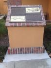
Inscription
Situated below this hill, directly below the hotel, is the Pablo Pryor Adobe-Hide House. Built perhaps as early as 1790, it is possibly the oldest standing adobe in California. During the Rancho period, it was used for storing cattle hide from the mission. An Indian lookout and runner was also stationed there so he could alert the town if a pirate (Hippolyte de Bouchard) ship was approaching. The hill is also believed to have been an ancient Juaneño encampment site.
The Mission used cattle hides in many ways and they were a leading item of trade for the mission community. They were used to purchase supplies from the trading ships anchored in the harbor and thus were referred to as "California banknotes." A description in Richard Henry Dana's book Two Years Before the Mast, tells the story of what happened here in 1834: "Down this height we pitted the hides, throwing them as for out into the air as we could...the wind took them and they swayed and eddied about, plunging and rising in the air, like a kite when it has broken it's string."
In 1846, the property was granted to Emigdio Vejar by Pio Pico, the last Mexican Governor of California. It included 6,607 acres historically known as Boca de la Playa, "Mouth of the Beach," that included Doheny Park, Capistrano Beach and part of San Clemente. In 1860, the land was sold to Juan Avila who gave the house to his daughter Rosa upon her marriage to Pablo Pryor in 1864. Many generations of historic families have lived here ant it remains the private residence of Pablo Pryor's descendants today.
Details
| HM Number | HM1R27 |
|---|---|
| Tags | |
| Marker Condition |           5 out of 10 (2 reports) |
| Date Added | Tuesday, March 15th, 2016 at 1:01am PDT -07:00 |
Pictures
Photo Credits: [1] SLOWE
Locationbig map
| UTM (WGS84 Datum) | 11S E 437180 N 3703961 |
|---|---|
| Decimal Degrees | 33.47328333, -117.67610000 |
| Degrees and Decimal Minutes | N 33° 28.397', W 117° 40.566' |
| Degrees, Minutes and Seconds | 33° 28' 23.82" N, 117° 40' 33.96" W |
| Driving Directions | Google Maps |
| Area Code(s) | 949, 714 |
| Which side of the road? | Marker is on the right when traveling East |
| Closest Postal Address | At or near 33711 Camino Capistrano, San Juan Capistrano CA 92675, US |
| Alternative Maps | Google Maps, MapQuest, Bing Maps, Yahoo Maps, MSR Maps, OpenCycleMap, MyTopo Maps, OpenStreetMap |
Is this marker missing? Are the coordinates wrong? Do you have additional information that you would like to share with us? If so, check in.
Nearby Markersshow on map
Maintenance Issues
- Is this marker part of a series?
- What historical period does the marker represent?
- What historical place does the marker represent?
- What type of marker is it?
- What class is the marker?
- What style is the marker?
- Does the marker have a number?
- What year was the marker erected?
- Who or what organization placed the marker?
- This marker could use another picture or two.
- Can this marker be seen from the road?
- Is the marker in the median?


Comments 0 comments