Inscription
Montpelier became the Capitol in 1808, when the first State House was built. Ammi B. Young's 2nd State House, built in 1838 and destroyed by fire in 1857, was similar to this 3rd structure on the site, completed in 1859.
Details
| HM Number | HMF4R |
|---|---|
| Tags | |
| Placed By | Vermont Historic Sites Commission |
| Marker Condition | No reports yet |
| Date Added | Thursday, September 4th, 2014 at 4:11pm PDT -07:00 |
Pictures
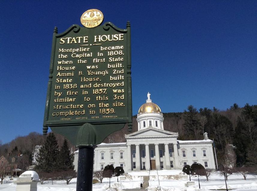
Photo Credits: [1] STEPHEN M. DICK
Locationbig map
| UTM (WGS84 Datum) | 18T E 693091 N 4903759 |
|---|---|
| Decimal Degrees | 44.26146667, -72.58096667 |
| Degrees and Decimal Minutes | N 44° 15.688', W 72° 34.858' |
| Degrees, Minutes and Seconds | 44° 15' 41.28" N, 72° 34' 51.48" W |
| Driving Directions | Google Maps |
| Area Code(s) | 802 |
| Closest Postal Address | At or near 125 State St, Montpelier VT 05602, US |
| Alternative Maps | Google Maps, MapQuest, Bing Maps, Yahoo Maps, MSR Maps, OpenCycleMap, MyTopo Maps, OpenStreetMap |
Is this marker missing? Are the coordinates wrong? Do you have additional information that you would like to share with us? If so, check in.
Nearby Markersshow on map
Show me all markers in: Montpelier, VT | Washington County | 05602 | Vermont | United States of America
Ammi B. Young
Vermont Equality For Same-Sex Couples
Ethan Allen
Senator William Upham
Montpelier Recreation Field
First Boy Scout Troop in America Barre, Vermont
First Boy Scout Troop
Clarence W. Fitch
North Montpelier Historic District
In the late 1950's Rock of Ages experimented with making lanes out of granite...
Maintenance Issues
- Is this marker part of a series?
- What historical period does the marker represent?
- What historical place does the marker represent?
- What type of marker is it?
- What class is the marker?
- What style is the marker?
- Does the marker have a number?
- What year was the marker erected?
- This marker could use another picture or two.
- Can this marker be seen from the road?
- Is the marker in the median?
Comments 0 comments