Inscription
Congratulations! You are helping to protect the environment. By choosing to ride the Light Rail instead of driving a car to your destination, you are conserving fuel, decreasing emissions, and reducing pollutants in the air and water.
Many of the pollutants that impact our streams and reduce water quality come from gasoline-powered cars. The dirt and emissions from vehicles are deposited on the roadway and in the air. Each rain washes the contaminants directly to the stream. Pollutants from the streams also impact the water quality in the Chesapeake Bay.
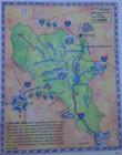
The stream near this Light Rail station flows to the Gunpowder River. Much of the Light Rail line is adjacent to area streams. As you travel south from this station, you will see Roland Run and Lake Roland. These waterways flow to the Jones Falls river and eventually join the Inner Harbor and the Chesapeake Bay. Like the Bay, waters in the Jones Falls watershed are critical habitat for many species. Many of the streams in the Jones Falls watershed support trout. Trout are sensitive to pollution and are indicators of healthy streams and excellent water quality. Not all the streams in the Jones Falls are in such a healthy condition. Areas that are urbanized like Roland Run, suffer from erosion, increased runoff and an influx of pollutants. The resulting poor water quality and loss of habitat create conditions that will not support sensitive species like trout.
The State of Maryland ranks among the best places in the nation to live for protection of natural resources. Within the state, Baltimore County is one of the top counties focused on protecting the environment. Our streams, woodlands, and natural areas contribute to our quality of life and are assets worth protecting.
Thank you for taking Light Rail today and doing your part to protect the streams. If you would like to discover more ways to protect and restore our streams, or just want to learn more about watersheds, contact the Jones Falls Watershed Association, your local watershed association or Baltimore County.
Details
| HM Number | HM5C7 |
|---|---|
| Additional Information | In poor condition 09-2016 |
| Tags | |
| Historical Period | 20th Century |
| Historical Place | River, Other |
| Marker Type | Other |
| Marker Class | Neither |
| Marker Style | Free Standing |
| Placed By | Maryland Department of Transportation |
| Marker Condition | No reports yet |
| Date Added | Thursday, September 18th, 2014 at 5:07am PDT -07:00 |
Pictures
Locationbig map
| UTM (WGS84 Datum) | 18S E 359296 N 4367789 |
|---|---|
| Decimal Degrees | 39.44818333, -76.63523333 |
| Degrees and Decimal Minutes | N 39° 26.891', W 76° 38.114' |
| Degrees, Minutes and Seconds | 39° 26' 53.4600" N, 76° 38' 6.8400" W |
| Driving Directions | Google Maps |
| Area Code(s) | 410, 443 |
| Can be seen from road? | No |
| Is marker in the median? | No |
| Closest Postal Address | At or near 99 Landstreet Rd, Lutherville-Timonium MD 21093, US |
| Alternative Maps | Google Maps, MapQuest, Bing Maps, Yahoo Maps, MSR Maps, OpenCycleMap, MyTopo Maps, OpenStreetMap |
Is this marker missing? Are the coordinates wrong? Do you have additional information that you would like to share with us? If so, check in.
Nearby Markersshow on map
Show me all markers in: Lutherville-Timonium, MD | Baltimore County | 21093 | Maryland | United States of America
Baltimore & Susquehanna Railroad Marble Track Bed
Baltimore and Susquehanna Railroad Marble Track Bed
White Marble Block
Cornerstone from Wesley Chapel
Millstone
Property Boundary Marker
Third and Last County Almshouse
Memorial to Marylanders-Liberation of Kuwait, a War Memorial
Memorial to All Marylanders who lost lives to Terrorists, a War Memorial
Field of Honor, a War Memorial
Maintenance Issues
- Is this marker part of a series?
- Which side of the road is the marker located?


Comments 0 comments